![]()
![]()
FSTerrain 2002
| ........End of an era? The Mesh side of Flight Simulator scenery has advanced by leaps and bounds over the last year and now there are numerous varieties of source DEM data available in a bewildering array of formats. There are also numerous tools arriving on the scene to help with processing these formats into Flight Simulator scenery. FSTerrain was only ever intended as a convenient way for me to create mesh scenery from the only widely-available format available at the time - USGS GTOPO30 30 second dem. It has since been bodged, tweaked and cajoled into supporting USGS 3 second data and now SRTM 3 second hgt but the time has come to admit that it has reached its limit as a general purpose mesh tool. There are just too many possible formats to even hope to be able to incorporate in the already-creaking framework of FSTerrain So......it is now officially "Retired". There will be no further development. I may still put out specific tools for aspects of the mesh scene (like the HGT Viewer on my Beta page ) but I don`t see any new versions of FSTerrain appearing. I will leave the last versions available here for people who might find some occasional use for them. 21/12/03 |
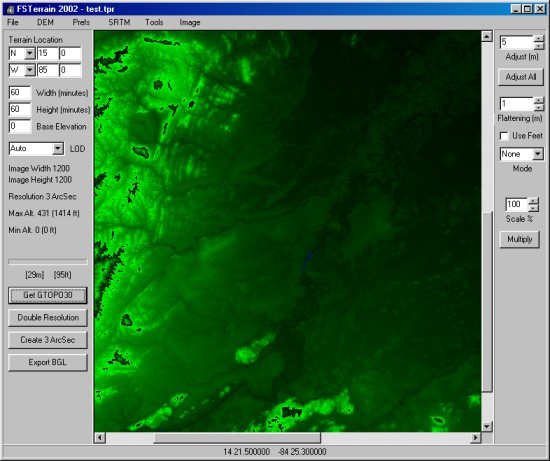
FsTrn22 is a program to attempt to make use of the FS2002 Terrain SDK tools for the creation of Enhanced Mesh terrain in FS2000, FS2002 and CFS2. The data is displayed graphically and can be edited in a paint program.
It has the ability to edit 16bit terrain data in a paint prog and convert to DEM/BGL.
It will create suitable INFand DEM files and run the SDK tools for you to directly create terrain bgls. It can
also interpolate the 30 second data to 15 sec, 7.5 sec or 3.75 sec data.
This latest version uses the FS2002 SDK resample program. It incorporates the following features :-
|
GTOPO30 DEM support |
Ability to create terrain from the 30 second USGS data freely available for the whole world. Data can be interpolated further to higher resolution and can be edited graphically. | |
|
USGS 3 arcsec support |
Ability to create terrain from the USGS 3 second data freely available for the United States | |
|
SRTM HGT support |
Ability to create terrain from the freely available 3 arcsecond SRTM data. This is currently for
North and South America with more areas to come as the vast mass of collected data gets processed. Functions are included to help with corrections to the errors that can appear in the radar-generated data. Correction for High-altitude voids and for the poor results of radar over large areas of water. GTOPO30 DEM data can be merged to help correct SRTM errors |
|
| Example Pictures | ||
| Version History | ||
|
4.00.7 |
Added "Import Greyscale" option and modified the "Send to Editor" routines so that it is now passed in a form that can actually be edited (though at some cost to Elevation resolution) | |
|
4.00.12 |
Added a new "SDK Errors" switch to cope with the strange quirk of the SDK tools discovered
by Burkhard Renk (FSRail) to forget the longitude when you are west of Greenwich! Added experimental Flatten and Adjust functions |
|
|
4.00.18 |
Added a French Translation of the basic instructions (many thanks to Fabrice Diaz Plus - Lat/Lon readout of mouse position, Elevation in Feet as well as metres, simple 3 Sec USGS data import..... |
|
|
4.00.19 |
Corrected the miscalculations when converting metres to feet (thanks Bernard Chazot) | |
|
4.00.28 |
Many changes. Latest is the return of 3 second interpolation | |
|
4.00.29 |
Bugfix for 3 sec | |
|
4.00.32 |
FSTerrain 2002 replacing the old version. New features and designed for the updated SDK tools provided for FS2002 | |
|
4.00.33 |
Fix to correct the incorrect conversion of Latitude. Added "Merge GTOPO30" option to the SRTM error-correction options | |
|
4.00.37 |
Fix to catch spuriously high elevations in SRTM data | |
Download FSTerrain 2002 (self extracting exe)
Download the old FS2000 FsTerrain Beta
| Download the Latest dll Set (required unless you already have it) |