![]()
![]()
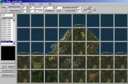
CfsTMap
A Utility for creating Elevated-Mesh Scenery for CFS using the default Ground Textures
| Features Include | |
|
Ability to use any standard CFS ground textures rotated in steps of 90 degrees without the need to distribute textures with the final scenery |
|
|
Automatic Matching of tiles at the click of a button. If at all possible textures will changed so that there is 100% matching of all tiles to their neighbours. |
|
|
Option to Lock any tile to prevent it being changed during matching (to protect the important areas of the scenery) |
|
|
Creation of totally Random Scenery with Automatic Matching. Creation of every possible rotation of the Default texture for maximum matching with realistic results |
|
|
Matching can be set to use all possible rotations of the Default bitmaps for the best chance of a Full Match |
|
|
Adjoining layouts can be set and the edge textures included in the Matching process |
|
|
Output as Scasm source code for external compilation |
|
|
Direct Compilation to BGL plus the facility to copy the bgl to the selected CFS scenery folder and to run CFS to see what it looks like. |
|
|
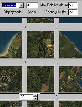
Import Edge-elevations from adjoining layouts. Create Randomised Elevations. Use Elevation-interpolation to "smooth" terrain. Set all Water tiles to zero elevation |
|
|
Ability to set the Layer priority of a layout so that several "Construction Kit" layouts can be created and overlayed in CFS to correctly display |
|
|
Functions to allow the creation of adjoining scenery areas with assistance in matching the new layout to the edge of the previous one - cover the empty world outside CFS-Europe! |
|
|
Fill unlocked areas with a single image or with random images (with auto-matching) |
|
|
|
|
|
|
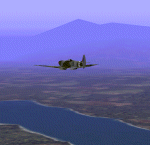
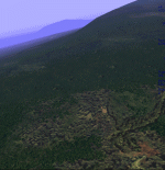
River Valley |
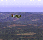
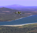
Isle of Arran |
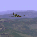
Kauai |
|
|
|
|
|
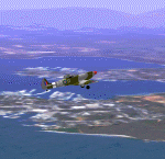
Oahu |
Hawaii |
Guadalcanal |
|
4.00.8 |
25/02/00 |
Initial Release |
|
4.00.9 |
27/02/00 |
Fixes a bug that caused problems in scenery when used in Quick Combat mode |
|
4.00.10 |
08/03/00 |
Update to include MeshWith.... Commands and a Classlist Generator |
|
4.00.11 |
14/03/00 |
Update to include DEM elevation data import and a simple AFD Generator |
|
4.00.12 |
25/03/00 |
Update to include AutoLayout and AutoDEM functions to help automate a lot of the steps in creating multiple layouts |
|
4.00.13 |
26/03/00 |
Update to include selectionof different Bitmap DAT files for using Extra bitmaps. Also DAT and Classlist files for Misho Katulic`s "Extended CFS Bitmap set" |
|
4.00.14 |
31/03/00 |
Update to cure a bug in base elevation calculation. Added - new feature in MkClass to create "Local" Classlists that can override the default classlist.bgl in small areas (for Hardening Water for carrier landings mainly) Split Downloads now so that the addon tools are downloaded separately (to keep download sizes under control) |
|
4.00.15 |
01/04/00 |
Changes to the way that moving to new layouts is calculated should (finally!) do away with cracks and misalignments at higher Latitudes. |
|
4.00.17 |
06/04/00 |
Added AutoDEM "Texture by Elevation", Compatibility switch to allow mixing of TexRelief
and Classlist Layouts, Constant Lat/Lon/Alt display of Mouse position, MkAFD 1.1 - Allows the creation of CFS Runways as well as AFD menu entries |
|
|
07/04/00 |
MkAFD 1.2 - Corrects the placement of Runways. Faulty maths in 1.1 |
|
4.00.18 |
12/04/00 |
Added experimental method of utilising alternative addon versions of the standard ground textures |
View Documentation
| cfstmap.zip (includes mwgfx.dll) main Program Archive | |
| Latest CfsTmap Update (you must have cfstmap.zip installed first) | |
| Latest MkClass Tool (required for using the Classlist scenery options) | |
| Latest MkAFD Tool for Creating Location entries in the Airfield Menu (and Runways) |
Note that the Latest CfsTmap update always includes all previous Updates
| Download the Latest mwgfx.dll (required unless you already have it) |