|
|
|
|
Enhanced Mesh Scenery for CFS2
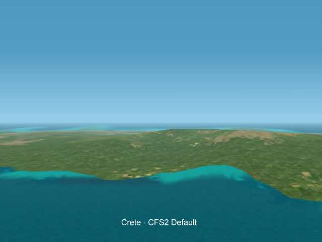
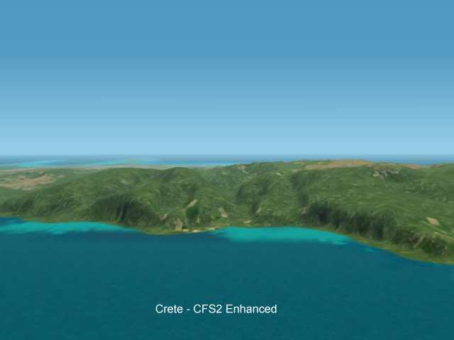
Crete
These images are VGA resolution 24 bit images so may take a while to all load.
CFS2 uses the same sort of DEM-Based terrain as FS2000. The default resolution for the world outside the Pacific area is 4km so even the GTOPO30 DEM freely available for the whole world offers a noticeable increase in terrain resolution (4x finer). Shown on this page is the effect of applying interpolated 15 second DEM data in the Crete Area.
Download the example at the bottom of the page.
Bare-Runway Airfields for Retimo and Heraklion available (with CFS2 Menu entries)
|
|
|
|